Manbane's Outcrop
From Guild Wars 2 Wiki
Jump to navigationJump to search
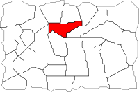
Manbane's Outcrop
1
 |
- Level
- 21
- Type
- Area
- Zone
- Diessa Plateau
(Ascalon) - Connects to
- Blackblade Lake (E)
Spider Nest Cavern (N)
Flame Temple Tombs (NE)
Bloodcliff Quarry (NW)
The Blasted Moors (S)
Rancher's Wash (SE)
Freewain Pastures (W)
| Image(s) |
|
Click to enlarge. |
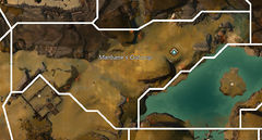
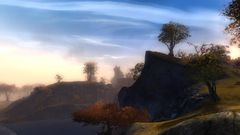
The Manbane's Outcrop is a cliff inhabited by black bears overlooking Blackblade Lake.
Locations and objectives[edit]
- Waypoints
- Manbane's Waypoint —
NPCs[edit]
Foes[edit]
- Black Bear (20)
- Veteran Black Bear (20)
- Warg (18)
- Crimson Moa (19)
Objects[edit]
- Diving Goggles - East of Manbane's Waypoint
Crafting resources[edit]
- Resource nodes
- Herb Sprouts
- Onions
- Gummo Sapling
- Iron Ore
- Silver Ore
Notes[edit]
- The Guild Race Devourer Burrow starts in this area.

