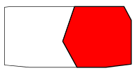
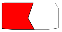
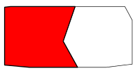
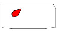
Description[edit]
Provides the logic for, and should only be used indirectly via, "Locators/<"within"-parameter value of the {{location infobox}}; as found on the area pages/map (page) name>"-subtemplates.
{{locators|<area to bound information definitions>|<floor definitions>}}
{{locators|<area to bound information definitions>|<floor definitions>|caption=<descriptive text>}}
{{locators|<area to bound information definitions>|<floor definitions>|locator=<locator file>}}
{{locators|<area to bound information definitions>|<floor definitions>|page=<page name>}}
Parameters[edit]
- 1 (unnamed parameter)
- One or more lines of area to bound information definitions. Area to bound information definitions consist of the following two parts, in that order, separated with a tilde:
- The page name of the area.
- The bound information applicable to the area. The bound information should be of polygonal nature and must be of the form as would be specified in the "imagemap"-element. Refer to mw:Extension:ImageMap#Syntax description for a description of the syntax.
- 2 (unnamed parameter)
- One or more lines of floor definitions. Floor definitions consist of the following three parts, in that order, separated with a tilde:
- The page names of the areas part of this floor. Multiple values must be separated with a semicolon. These values are what will be compared against the values passed to unnamed parameter one in order to determine the bound information for the area.
- Optional. The label for the floor. E.g. "Sky", "Ground", "Depths", etc. Multiple values must be separated with a semicolon. Should not be specified for maps where all of the areas are the same across all of the floors.
- Optional. The name of the file (without the namespace) for the image to show for the floor when the curent page does not describe any area on the floor, i.e. an image of the floor without any area highlighted. This may but should not be specified when this cannot occur; as would be the case for maps where all of the areas are the same across all of the floors.
- caption
- Optional. The text to display below all of the floor images.
- locator
- Optional. The name of the locator image for the area (without the namespace). Defaults to
<"page"-parameter value> locator.svg.
- page
- Optional. The name of the area page. Defaults to
{{PAGENAME}}.
Example[edit]
- /Bloodstone Fen
<includeonly>{{locators|
poly 152.44 97.13 67.72 106.75 67.72 962.59 439.84 996.31 455.28 595 401.97 486.22 474.59 375.41 742.47 306.97 742.47 306.97 628.16 550.72 455.28 595 439.84 996.31 1566.28 996.31 1947.63 949.25 1947.63 299.88 1839.13 97.13 152.44 97.13 152.44 97.13 [[Fragmented Wastes]]
poly 455.29 595 401.96 486.2 474.59 375.42 742.48 306.97 628.14 550.71 455.29 595 [[Pride of the Pact]]
---
poly 930.35 611.29 1106.31 97.13 1839.13 97.13 1947.63 299.88 1947.63 949.25 1566.28 996.31 1142.87 996.31 930.35 611.29 [[Bloodstone Maw]]
poly 67.72 106.75 152.44 97.13 1106.31 97.13 930.35 611.29 1142.87 996.31 439.84 996.31 67.72 962.59 67.72 106.75 [[Haunted Canyons]]
---
poly 930.35 611.29 1106.31 97.13 1839.13 97.13 1947.63 299.88 1947.63 949.25 1566.28 996.31 1142.87 996.31 930.35 611.29 [[Bloodstone Maw]]
poly 67.72 106.75 152.44 97.13 1106.31 97.13 930.35 611.29 1142.87 996.31 439.84 996.31 67.72 962.59 67.72 106.75 [[Cavern of Unseen Lights]]
|
Sky    ~ Bloodstone Fen area outlines (Sky).svg
Ground ~ Bloodstone Fen area outlines (Ground & Depths).svg
Depths ~ Bloodstone Fen area outlines (Ground & Depths).svg
|caption={{{caption|}}}|locator={{{locator|}}}|page={{{page|}}}}}</includeonly><noinclude>
{{locators/preview|
Bloodstone Maw
Cavern of Unseen Lights
Fragmented Wastes
Haunted Canyons
Pride of the Pact
}}
</noinclude>
See also[edit]

