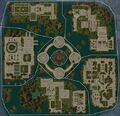
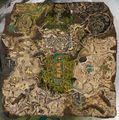
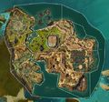
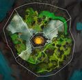
Category:Zone map images
From Guild Wars 2 Wiki
Jump to navigationJump to search
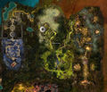
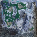
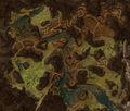
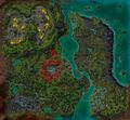
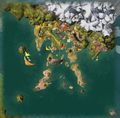
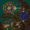
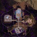
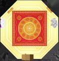
List of maps of explorable zones.
Media in category "Zone map images"
The following 98 files are in this category, out of 98 total.
- Amnytas map.jpg 4,195 × 4,060; 9.2 MB
- Auric Basin Exalted Trials map.jpg 2,628 × 3,516; 2.46 MB
- Auric Basin Jungle Treetop map.jpg 2,628 × 3,516; 3.38 MB
- Auric Basin map.jpg 2,628 × 3,516; 3.56 MB
- Bastion of the Penitent map.jpg 1,920 × 1,080; 503 KB
- Bitterfrost Frontier map.jpg 3,718 × 1,904; 2.01 MB
- Bjora Marches map.jpg 5,019 × 2,677; 7.67 MB
- Blazeridge Steppes map.jpg 2,807 × 5,350; 5.92 MB
- Bloodstone Fen level 1 map.jpg 2,062 × 1,080; 761 KB
- Bloodstone Fen level 2 map.jpg 2,062 × 1,080; 803 KB
- Bloodstone Fen level 3 map.jpg 2,062 × 1,080; 663 KB
- Bloodtide coast map full.jpg 2,432 × 3,201; 2.47 MB
- Bloodtide Coast map.jpg 2,925 × 4,069; 8.77 MB
- Blue Alpine Borderlands map.jpg 2,662 × 3,625; 4.61 MB
- Blue Desert Borderlands map.jpg 3,660 × 3,688; 6.43 MB
- Brisban wildlands map full.jpg 3,457 × 2,688; 3.5 MB
- Brisban Wildlands map.jpg 4,232 × 3,262; 4.41 MB
- Caledon forest map full.jpg 1,920 × 3,968; 3.35 MB
- Caledon Forest map.jpg 2,429 × 4,814; 7.23 MB
- Crystal Oasis map.jpg 6,336 × 3,344; 6.5 MB
- Cursed Shore map.jpg 2,802 × 4,799; 5.23 MB
- Desert Highlands map.jpg 6,507 × 3,581; 7.76 MB
- Diessa Plateau map.jpg 4,500 × 3,037; 5.68 MB
- Domain of Istan map.jpg 4,274 × 3,976; 6.08 MB
- Domain of Kourna map.jpg 8,512 × 9,917; 7.8 MB
- Domain of Vabbi map.jpg 5,820 × 3,902; 7.98 MB
- Draconis Mons floor 0 map.jpg 3,016 × 2,932; 1.81 MB
- Draconis Mons floor 1 map.jpg 3,016 × 2,932; 2.31 MB
- Draconis Mons floor 2 map.jpg 3,016 × 2,932; 2.26 MB
- Dragon's End map.jpg 2,519 × 4,218; 7.77 MB
- Dragon's Stand map.jpg 3,792 × 3,516; 3.58 MB
- Dragonfall map.jpg 4,344 × 3,519; 7.69 MB
- Dredgehaunt Cliffs map.jpg 3,132 × 4,102; 4.15 MB
- Drizzlewood Coast map.jpg 2,613 × 5,319; 7.3 MB
- Dry Top map.jpg 2,556 × 1,812; 1.83 MB
- Elon Riverlands map.jpg 4,257 × 4,482; 6.37 MB
- Ember Bay map.jpg 3,901 × 3,056; 5.34 MB
- Eternal Battlegrounds map.jpg 3,850 × 3,833; 5.11 MB
- Fields of Ruin map.jpg 3,692 × 3,839; 5.7 MB
- Fireheart Rise map.jpg 4,240 × 3,450; 5.88 MB
- Forsaken Thicket map.jpg 2,167 × 1,861; 3.92 MB
- Frostgorge Sound map.jpg 3,821 × 3,827; 5.37 MB
- Gendarran fields map full.jpg 4,230 × 2,115; 2.75 MB
- Gendarran Fields map.jpg 5,260 × 2,968; 4.04 MB
- Green Alpine Borderlands map.jpg 2,692 × 3,637; 4.73 MB
- Grothmar Valley map.jpg 3,851 × 3,137; 6.67 MB
- Gyala Delve map.jpg 2,292 × 4,156; 2.2 MB
- Hall of Chains map.jpg 1,920 × 1,024; 661 KB
- Harathi hinterlands map full.jpg 3,198 × 2,722; 2.59 MB
- Harathi Hinterlands map.jpg 4,086 × 3,415; 3.39 MB
- Iron Marches map.jpg 2,713 × 4,931; 5.43 MB
- Jahai Bluffs map.jpg 5,133 × 3,902; 7.53 MB
- Janthir Syntri map.jpg 3,687 × 3,412; 2.54 MB
- Kessex hills map full.jpg 4,096 × 2,048; 2.66 MB
- Kessex Hills map.jpg 5,336 × 3,012; 6.83 MB
- Labyrinthine Cliffs map.jpg 1,785 × 1,754; 1,009 KB
- Lake Doric map.jpg 2,262 × 3,198; 1.89 MB
- Lornar's Pass map.jpg 2,200 × 5,800; 6.6 MB
- Malchor's Leap map.jpg 4,873 × 2,735; 4.34 MB
- Metrica province map full.jpg 2,177 × 3,328; 3.32 MB
- Metrica Province map.jpg 2,698 × 4,110; 5.27 MB
- Mists Rift map (clean).jpg 640 × 640; 134 KB
- Mists Rift map.jpg 544 × 527; 85 KB
- Mount Maelstrom map.jpg 4,732 × 3,040; 6.99 MB
- Mythwright Gambit map.jpg 1,920 × 1,920; 1.17 MB
- New Kaineng City map.jpg 4,623 × 3,098; 12.05 MB
- Plains of Ashford map.jpg 5,105 × 2,676; 9.13 MB
- Queensdale map full.jpg 3,832 × 2,445; 2.8 MB
- Queensdale map.jpg 4,468 × 3,054; 5.54 MB
- Red Alpine Borderlands map.jpg 485 × 608; 147 KB
- Red Desert Borderlands map.jpg 3,228 × 3,245; 6.52 MB
- Sandswept Isles map.jpg 3,681 × 4,970; 5.8 MB
- Seitung Province map.jpg 4,639 × 3,274; 12.61 MB
- Siren's Landing map.jpg 3,642 × 1,707; 1.82 MB
- Skywatch Archipelago map.jpg 5,668 × 3,361; 10.6 MB
- Snowden Drifts map.jpg 5,190 × 2,927; 5.24 MB
- Southsun Cove map.jpg 3,543 × 2,251; 2.41 MB
- Sparkfly Fen map.jpg 3,206 × 4,208; 7.36 MB
- Straits of Devastation map.jpg 4,242 × 3,374; 4.86 MB
- Tangled Depths floor 0 map.jpg 3,972 × 2,604; 4.27 MB
- Tangled Depths floor 1 map.jpg 3,972 × 2,604; 4.58 MB
- Tangled Depths floor 2 map.jpg 3,972 × 2,604; 4.17 MB
- Tangled Depths floor 3 map.jpg 3,972 × 2,604; 3.65 MB
- The Battle For Lion's Arch map.jpg 2,836 × 1,803; 3.05 MB
- The Crown Pavilion (zone) map.png 880 × 880; 1.21 MB
- The Desolation map.jpg 4,257 × 6,405; 7.97 MB
- The Echovald Wilds map.jpg 4,580 × 2,984; 10.26 MB
- The Key of Ahdashim map.jpg 1,920 × 1,920; 1.23 MB
- The Silverwastes map.jpg 2,487 × 1,830; 1.74 MB
- The Wizard's Tower map.jpg 2,158 × 1,257; 1.3 MB
- Thunderhead Peaks map.jpg 4,111 × 4,558; 7.05 MB
- Timberline Falls map.jpg 3,215 × 4,271; 5.94 MB
- Verdant Brink Abyss map.jpg 3,836 × 1,940; 2.77 MB
- Verdant Brink Canopy map.jpg 3,836 × 1,940; 2.68 MB
- Verdant Brink map.jpg 3,836 × 1,940; 5.78 MB
- Wayfarer Foothills map.jpg 2,492 × 5,875; 4.96 MB
- World 1 House map.jpg 1,129 × 1,155; 217 KB
- World 2 House map.jpg 1,447 × 987; 192 KB
