Category:Timberline Falls area maps
From Guild Wars 2 Wiki
Jump to navigationJump to search
Media in category "Timberline Falls area maps"
The following 28 files are in this category, out of 28 total.
- Bynebrachen map.jpg 678 × 1,227; 322 KB
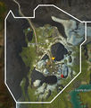
- Candle Chimney map.jpg 665 × 807; 175 KB
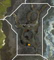
- Fionnghuala Scratch map.jpg 794 × 879; 244 KB
- Fisher's Eye Bridges map.jpg 1,039 × 735; 239 KB
- Gentle River map.jpg 1,494 × 1,345; 685 KB
- Guilty Tears map.jpg 1,038 × 804; 308 KB
- Gyre Rapids map.jpg 932 × 817; 286 KB
- Hunting Banks map.jpg 927 × 597; 199 KB
- Krongar Pass map.jpg 856 × 1,004; 305 KB
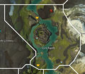
- Lair of the Coil map.jpg 781 × 721; 230 KB
- Malorean Wilds map.jpg 595 × 548; 150 KB
- Mellaggan's Grotto map (underwater).jpg 1,199 × 963; 443 KB
- Mellaggan's Grotto map.jpg 1,199 × 963; 462 KB
- Molodets Excavation map.jpg 755 × 1,006; 357 KB
- Naui Waters map.jpg 847 × 767; 238 KB
- Nonmoa Lake map.jpg 1,255 × 1,009; 364 KB
- Pythian Point map.jpg 825 × 857; 283 KB
- Scale Strand map.jpg 427 × 873; 132 KB
- Sector Zuhl map.jpg 826 × 1,060; 410 KB
- Serpent Stones map.jpg 841 × 861; 265 KB
- Stromkarl Heights map.jpg 660 × 997; 255 KB
- Tail of the Serpent map.jpg 525 × 736; 158 KB
- Talus Waterslide map.jpg 767 × 673; 198 KB
- The Foundation Stones map.jpg 416 × 696; 110 KB
- The Iron Veil map.jpg 798 × 1,003; 284 KB
- Tyrant's Mount map.jpg 631 × 866; 222 KB
- Ural's Delve map.jpg 594 × 617; 193 KB
- White Paper Hill map.jpg 1,115 × 1,007; 403 KB


